Monday, May 30, 2011

Looking up before looking down.


On the road again after some rest in Zion, Hebrew for "place of refuge." For us, the five days provided much needed rest and plenty of vegetation to refill the metabolisms. The majority of the campsites in the park sit vacant but occupied as the visitors hike the plethora of trails. Ours on the other hand, was commonly guarded by us lazy cyclists; which is not to say we didn't do or see anything, only that we spread two days worth of activities into five. Why not? It's not like we have to go back to work any time soon.

A big thanks to our special weekend guests Emily and Melanie, who drove down from Portland to deliver replacement parts, books, and most importantly; beer and delicious food.

As the few Americans headed out of Zion on Memorial Day, so did we. Our next destination; Bryce Canyon National Park to see the artfully eroded hoodoos. On our ride east on highway 9 out of Zion, we were forced to hitch rides through the dark and narrow Carmel tunnel. Once through, we were immediately introduced to beautiful red slick rock, and a side of Zion much different, yet equally as beautiful as the infamous canyon.

Zion to Bryce is about 80 miles; an easy distance over two days, with an elevation increase of roughly 3,000 feet. As I'm told, in Zion you look and hike up, and in Bryce it's down. I'll give a first hand account later, it's time to hit the trail.

Saturday, May 28, 2011

Into the high life.


Steering towards the Great Basin National Park, we turned south off of Highway 50 to encounter our longest stretch, 80 some miles, without the services of a town. We decided not to make the 1,000+ foot climb to the campgrounds inside Great Basin, and instead camp just up the hill from the small town of Baker, in Snake Valley. Being aptly named, it was here where we encountered our first rattlesnake of the trip, guarding the dirt road leading to our improvised BLM camp. After spotting camp, we took a short hike uphill to accidentally find ourselves walking into the park through the back entrance, not a bad place to borrow some free land.

The next day, we began our push south and into our fourth state of the trip, Utah. As a representation of the geology ahead, the Utah asphalt transitioned into a tint of red. The stretch of road on Utah's highway 21 from Garrison to Milford may not have the reputation for loneliness, but for this same reason, it is lonelier.

The nearly two weeks we spent crossing northern Nevada to Zion National Park in southern Utah has left us a bit exhausted and ready for some stationary time over the Memorial holiday weekend. Our bikes are also ready for new chains and other drivetrain accessories, which we'll replace between hikes and naps.

Having never visited the southwest, I'm surprised to see how internationally famous a place like Zion National Park is. On the trails and around the visitor center, there are mutterings of foreign languages floating about, mostly European. For me, this is a reminder that people from around the world consider the USA an interesting travel destination. Furthermore; although this country may have a slight reputation of international greed, control, and may not be the most popular promoter of peace; I take comfort in thinking those who come from afar to walk among the commoners will see that our lifestyles are more similar than different. They can realize that we are all human beings, who naturally promote the health of our family first; then community; then region; then country. Wrong or right, it's a survival instinct.

Thursday, May 19, 2011

Highway 50 and the high desert.


In the tradition of inaccurate expectations, our continuing journey across northern Nevada on Highway 50 has been far from what we anticipated. Failing to check the almanac combined with our lack of experience outside the northwest USA has left us surprisingly cold out here in this high desert. Ignorantly miscategorizing all desert climates south of Oregon as hot, our base layers and coats have been pulled from the depths of our packs to once again keep us warm. On the other hand, this stretch has provided many diverse and scenic landscapes for us to enjoy and photograph. The mountain passes reach around 7,500 feet, and each range is separated by 15 to 20 mile wide valleys, which are traversed by the straightest stretches of road I have ever seen. It's possible to see the road from 15 miles or more across these valleys; a two lane road can become very small before it disappears. Out here, we have seen all varieties of weather; wind/sand storms, rain, snow, hail, lightning, and even sun. Without thermometers, we have only been able to measure the freezing level on the mountains and foothills surrounding us.

As mentioned, in our cut eastward, the options for camping in designated campgrounds have dwindled. On the desolate stretches of Highway 50, most of the land is BLM (Bureau of Land Management) land and the people out here know how to use it. In the tradition of the wild west, the inhabitants of the small towns encourage free use of the land, for it is our tax dollars that pay for it, therefore it is ours to use; unless we burn it down or use it for something illegal. This free access is something unique to the vast open spaces of our country, places undesirable to the private land owner. As we continue our way through to the southwest and down into Texas, I hope for more of the same free living. As the population increases, and the landscapes transform, we will encounter new obstacles for obtaining free tent space.

One free, yet valuable resource we happened upon a few days ago are the Spencer hot springs outside a small town called Austin. As told, this place use to be a big resort. Today, the site is completely unmarked from any access road, and consists of a handful of spring fed pools. We spent a rest day soaking, relaxing, and watching the weather patterns blow along the mountain range five miles away, on the opposite side of the valley. All 100% free; country club living without the dues.

One final note regarding the third picture in this post. We recently encountered a man on a walk from San Francisco to Missouri. The simple feat of walking is an ambitious objective, but this man is doing it while dragging a cross and 150 pounds of gear in a trailer. We shared camp for a night and learned he is an interesting fellow with a commitment and passion for his beliefs. He told us there was another man a day behind him walking the same stretch of Highway 50 to advocate same sex marriage. Only in America.

Friday, May 13, 2011

To Carson City and beyond.

Although Truckee is a wonderful place full of plenty to do while not riding bikes, we've been here too long and it's time again to hit the road. Kane's frame arrived early, and now his partially new and hopefully improved touring steed is ready for it's debut. We depart Truckee for the lonesome highway across Nevada. We're expecting long and desolate straights as far as the eye can see, hot afternoons, and majestic mirages. This next section will be a test of our endurance and will as we experience the modern day pony express.

Thanks once again to Sonia, Brad, and the city of Truckee for being such awesome hosts through our time up the creek. Also to Kona and Sellwood Cycle Repair for being so understanding and expedient in our time of need.

Ciao.

Monday, May 9, 2011

Truckee down time.


As we continue our wait for the replacement frame, we have had a chance to do some serious relaxing, eat some great food, catch up on last year's Oscar nominations, score some schwag at a naked lady party, and play some disc golf. All in all, the down time has been a great reminder of why we are partaking in this trip; to enjoy the freedom from work while enjoying the greatness this country has to offer. Truckee is not a bad time or place to find a crack in your frame.

Saturday, May 7, 2011

Signs of suffering, signs of success.


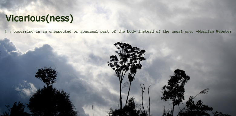
Climbing up a big hill for the first time, false summits are a big let down. Trying to guess the approximate distance from the top by looking for signs, it's easy to be too optimistic and end up disappointed by the truth. The longer the climb, the more this scenario is dramatized, and the more emotions fluctuate between excitement and devastation. Our climb up and over Carson Pass called for three days of slow and steady pushing, making our completion quite satisfying.

We ended our summit day at the base of Luther Pass, which was only a small morning jaunt to get the legs going the next day. From the top of Luther Pass, we enjoyed six miles downhill on a six percent grade with an average speed of approximately 40mph. As we were accelerating from the top, drafting each other in close formation, we couldn't help but believe this was the funnest thing we could have been doing at that very moment. We also couldn't resist the notion that those watching us from their cars must have believed the same thing. Pedaling bicycles up big mountains and then riding them down presents an interesting juxtaposition for those watching from their cars. Going up, they likely feel pity for our suffering; going down, they likely envy our enjoyment.

Reaching Lake Tahoe, we travelled the western shore, through Emerald Bay and Squaw, down into Truckee where we now reside. Our intent was to spend two nights here to recuperate and prepare for the long and lonesome stretch of highway across Nevada. But alas, Kane noticed a crack in his frame, which is forcing us to stay put for a few days as the replacement comes in. Considering all the places we could be stuck, Truckee ranks as one of the best. There is plenty to do and see here, and the people are amazingly friendly, hospitable, and interesting. We hope to utilize our time playing disc golf, soaking in hot springs, and maybe doing a little spring snow recreation.

We have officially been on the road for just over a month. In that time, we have had some extraordinary experiences, met some great people, and accomplished rewarding tasks. None of this could have been possible without the help of so many people from back home, and out on the road. A special thanks goes out to Sellwood Cycle Repair and Kona for helping prepare Kane and I, and providing continuous support on the road; to Village Bike and Ski and Vulture Cycles for helping prepare Dan, and providing continuous support on the road; to Corinne and friends in San Francisco; Alex, Larry, and friends in Sacramento; Brad, Sonia, and friends in Truckee; all our family and friends back home and out in front of us; and to all the people who have and will share kind gestures of hospitality and support as we make our way towards our destinations. We could not have made this trip a success without the help of other people.

Days on the road: 33.
Distance travelled: 1,216 miles.
Highest elevation: 8,574 feet.
Broken spokes: 7.
Flats: 1.
Broken frames: 1.
Colds: 3.

Friday, May 6, 2011

The foothills to glory.


Sacramento is somewhere around 25 feet in elevation; Lake Tahoe is somewhere around 6,225 feet; the route between is 100 miles and carries over at Carson Pass at 8,574 feet. We cruised out of Sacramento along the American River bike trail, which winds upstream to Folsom; the same Folsom which houses the prison where Johnny Cash performed in front of a live, incarcerated audience. My experience with pedestrian/bicycle paths is limited to the Springwater in Portland and the Han river/tributary bike trails in Seoul; both of which are straight and flat. Riding the American River trail was quite a different experience for this reason; although the pitch is consistent with a steady flowing river, the path winds in, out, and around.

From Folsom, we continued east through Placerville (a.k.a. Hangtown) and into the Eldorado National Forest. As we pushed along closer to the final slog up and over, the relief of occasional downhill breaks became more and more sparse. In consideration of climbing mountain passes, what goes down has to go back up, so it's tough to be disappointed.

The bounty of state and national parks all along the west coast provided us plenty of hiker/biker camping. Camping in our eastbound leg has been quite different since there is more private property and fewer parks. We have been forced to be more creative with our camping spots, utilizing cattle land, closed forest service roads, and a variety of other open spaces. On one occasion, we were lucky enough to meet a kind winery owner who offered up free access to his family's horse range. Although our new camping situations are less predictable and harder to plan out, our vulnerability has and will provide more opportunities to reach out and be reached out to. I hope, as we continue to move across this country, that we find many more opportunities to accept random acts of hospitality and peek into the lives of kind people.

Thursday, May 5, 2011

Vallejo -> Davis -> Sacramento


From San Francisco, we caught a ferry to Vallejo to avoid the hectic bay area riding. In our first true segment riding east, we could notice a significant change in climate. No longer did the wind cool itself over the water to give us the refreshing, sometimes cold breeze. In two days, we covered the distance between Vallejo and Sacramento. In between we enjoyed the flat and straight farmland, and as an added bonus, a tailwind. As we began our second day, it was clear we had reached the Davis vicinity; recreational riders were coming and going all along the route into town.

I was especially excited to ride through Davis because of its noted reputation as a bicycling city. People from many different walks of life were riding around town as if we had reached Copenhagen or Amsterdam instead of a farm community in California. In consideration of all the bells and whistles included in the Davis bicycling infrastructure, I was most excited about the cycling roundabouts. Not only are they extremely fun to ride around, the functionality is far superior to the standard intersection most commonly seen at the convergence of two bike paths.

Sacramento was a great place to stay for a few days. Although we rode only two of nine days between our stays in San Francisco and Sacramento, we took the opportunity to soak in the cultures of two very different Californian cities.